PUBLIC NOTICE: ROAD CLOSURES
Pursuant to s.58 of the Land Administration Act 1997, the Shire gives notice of its intention to close the following public roads:
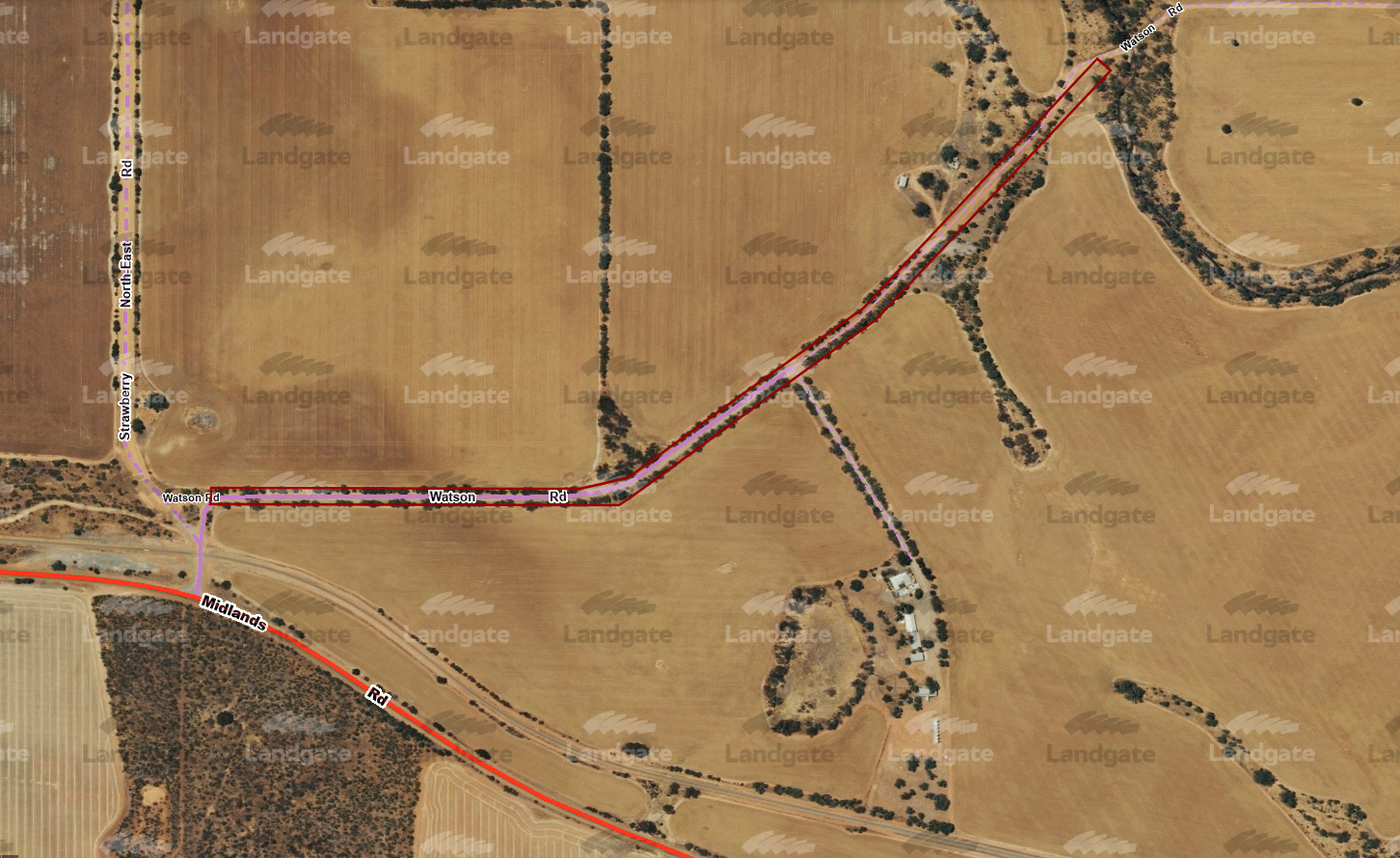
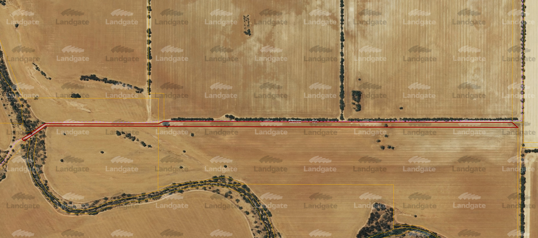
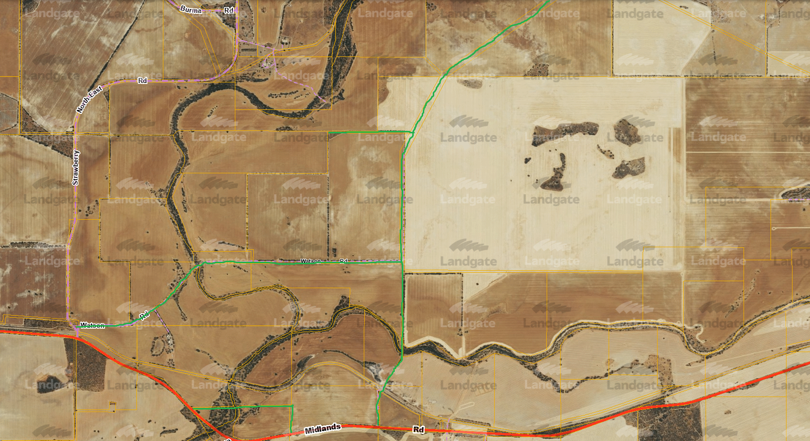
- Land ID 3778178 (Watson Rd from Midlands Rd to landowner homestead) – view map
- Land ID 3729116 (Watson Rd reserve running east from homestead) – view map
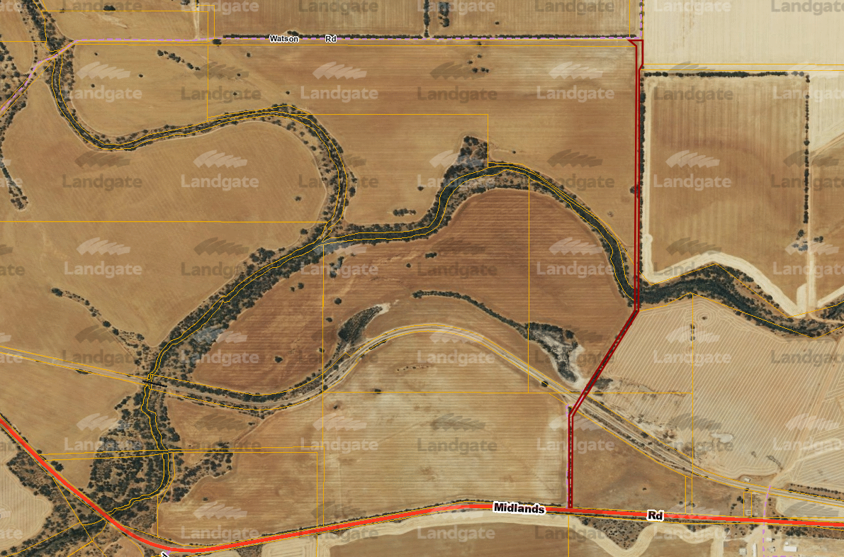
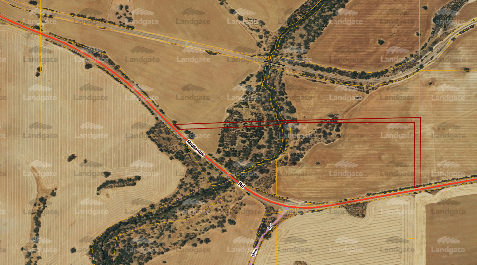
- Land ID 3727403 (Watson Rd reserve running south from Land ID 3727403 to Midlands Rd) – view map
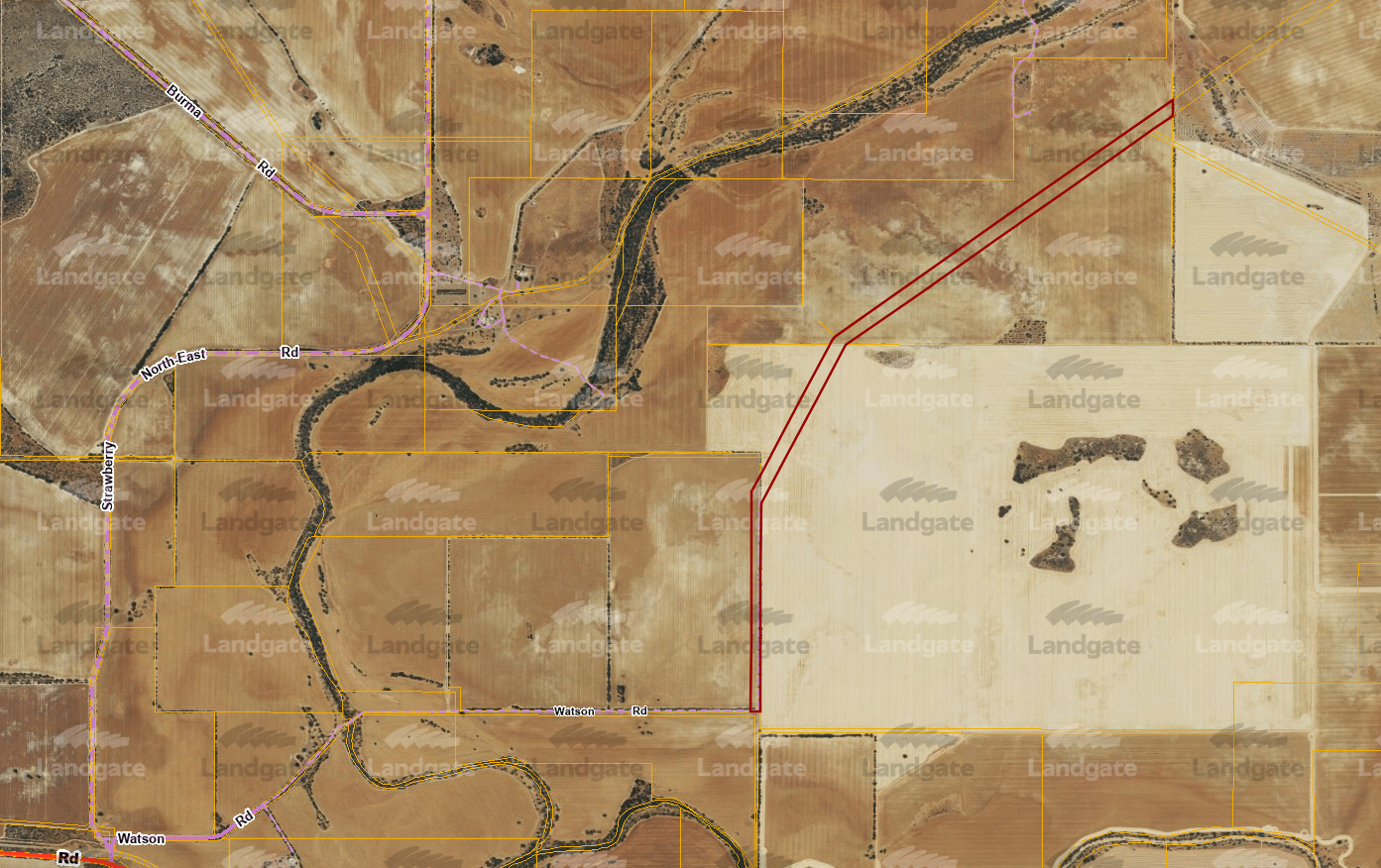
- Land ID 3727402 (Watson Rd reserve running north from Land ID 3727403 to 3727393) – view map
- Land ID 3727393 (Watson Rd reserve running west from 3727402) – view map
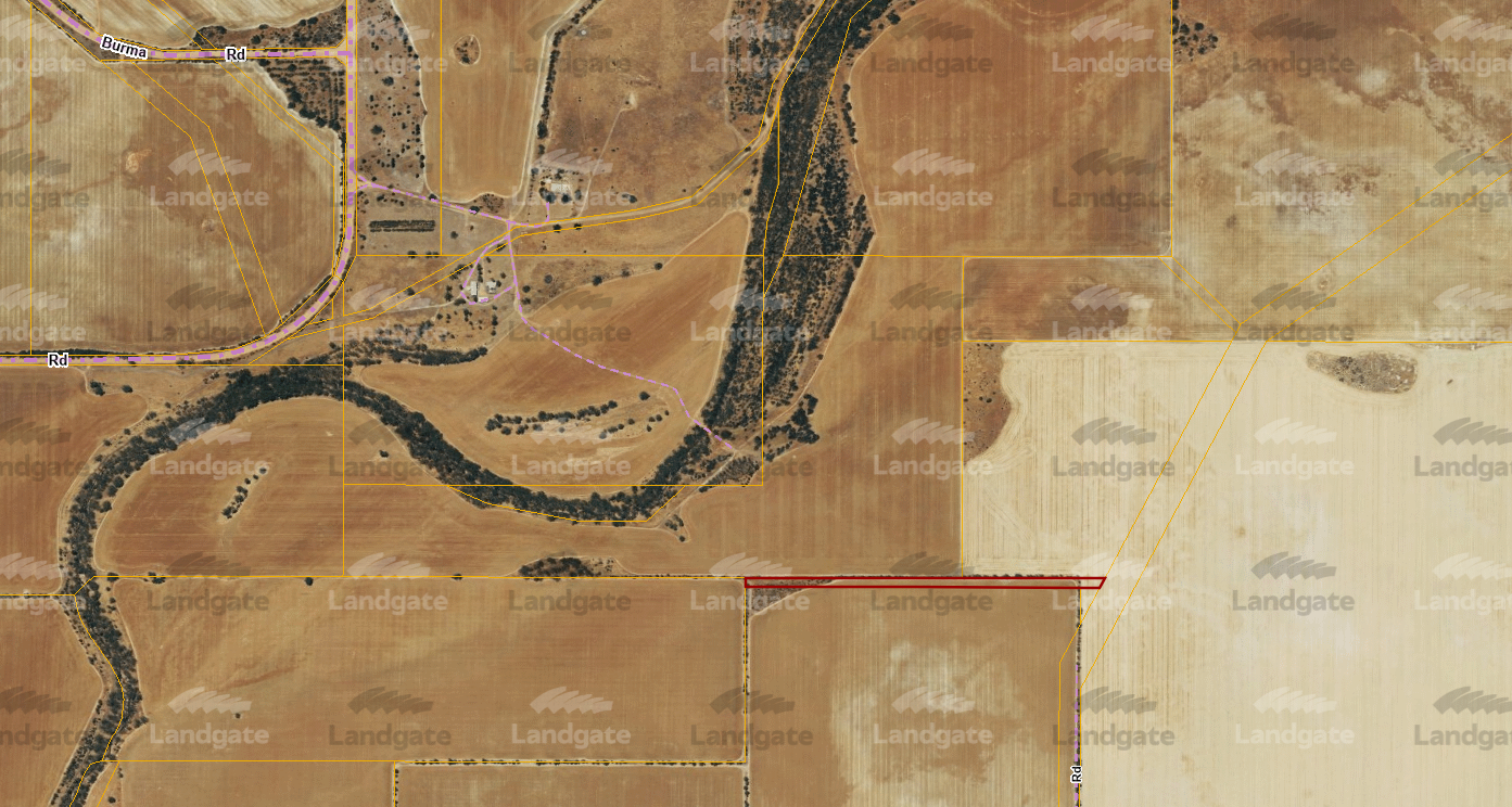
- Land ID 3729111 (unnamed road from Midlands Rd near Strawberry bridge) – view map
An overall map of the road closures can be accessed here.
You also have the option to visit Landgate’s Map Viewer tool to view the interactive map and search each land ID or area.
The request to close the roads has been on the basis that the roads are exclusively used to gain access to privately owned property.
Any submissions or objections to the road closure may be submitted by 9am Monday, 12 August 2024 via email to governance@mingenew.wa.gov.au, in person to 21 Victoria Street, Mingenew WA 6522 or by mail to PO Box 120, Mingenew WA 6522. All submissions will be considered at a meeting of Council prior to application being made to the Minister.
For any enquiries please contact Erin Greaves, Manager Governance and Community on (08)9928 1102.
Matt Fanning
Chief Executive Officer
2 July 2024